

About the record
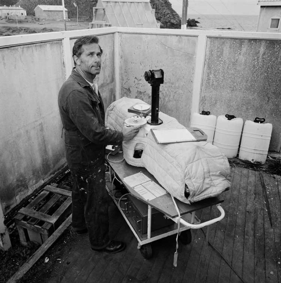
This is a black-and-white photograph taken at Macquarie Island in Antarctica in 1978. It shows Geoff Garnham, in a shelter, measuring the ozone—probably using a Dobson spectrophotometer. There are houses and the sea in the background.
Educational value
- The Dobson photoelectric spectrophotometer in this 1978 photograph is probably still used today to measure ozone levels. Over the years, the instruments used on Macquarie Island have kept pace with developments in technology. For example, the Upper Air program now relies on global positioning system (GPS) radiosondes to measure temperature and humidity in the upper atmosphere, but the older technology is still used as a check on the automated system.
- Measurement of the ozone began in the 1860s. International measurements of ozone began with the International Geophysical Year in 1957. The first satellite observations began in 1978 with the Nimbus-7 satellite carrying a Total Ozone Mapping Spectrometer (TOMS). It was not until the discovery of the Antarctic ozone hole in 1985—and airborne measurements taken by NASA over Antarctica in the spring of 1987—that a link between ozone depletion and manufactured chemicals was established.
- Scientific measurement such as that shown in the photograph ultimately led to the Montreal Protocol on Substances that Deplete the Ozone Layer, signed in 1987 and substantially amended in 1990, 1992 and 1997. This international agreement, designed to protect the stratospheric ozone layer, stipulates that the production and consumption of compounds that deplete ozone in the stratosphere are to be phased out. It has been one of the most successful environment protection agreements in the world.
- Macquarie Island has been a centre of scientific research for nearly a century. Douglas Mawson established the first scientific station at Macquarie Island in 1911 with a science program that included geomagnetic observations, studies of botany, zoology and geology, and regular meteorological observations. Australia's Commonwealth Meteorological Service continued the weather observations program until 1915, when the sinking of the ship Endeavour, with the loss of all on board, led to the abandonment of the scientific station.
- The research station in the photograph was established in 1948 by Australian National Antarctic Research Expeditions (ANARE, pronounced ‘an-ah-ree’). Weather observations made there have led to a good understanding of sub-Antarctic weather systems.
Acknowledgments
Learning resource text © Education Services Australia Limited and the National Archives of Australia 2010.
Related themes
Need help with your research?
Learn how to interpret primary sources, use our collection and more.


