

About this record
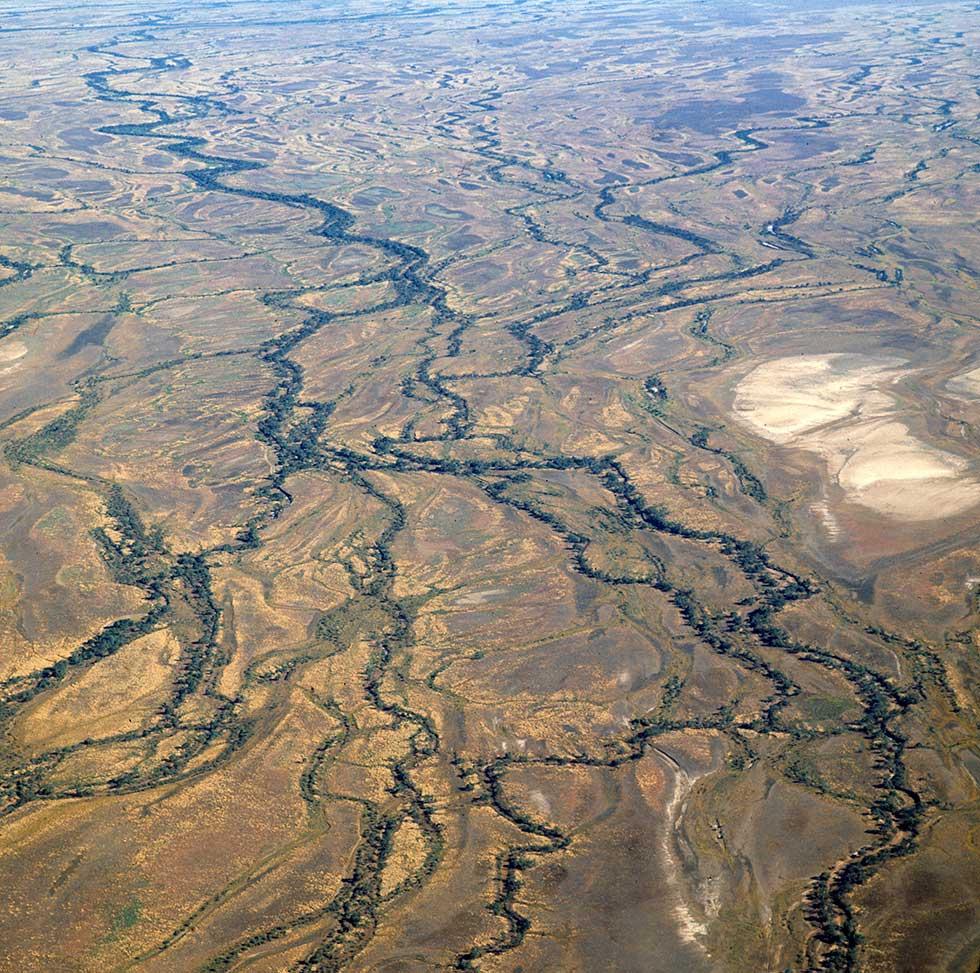
This colour photograph is an aerial view of a portion of the Channel Country bioregion of inland Australia, showing the region's vast network of flood and alluvial plains, and multiple-branching watercourses or channels that give the region its name. The photograph was taken in the Northern Territory, possibly on 20 December 1974. A large saltpan can be seen to the right.
Educational value
- The Channel Country bioregion consists of about 284,700 square kilometres of arid and semi-arid land within Queensland, South Australia, the Northern Territory and New South Wales, with approximately 70 per cent of the region lying within the southwestern corner of Queensland. The bioregion includes the catchments of Cooper Creek and the Diamantina, Bulloo and Georgina rivers, and lies within the Lake Eyre Basin system that drains about one-sixth of Australia (about 1.2 million square kilometres).
- In this vast, almost flat, area most of the channels, including those seen here, are ephemeral and anastomosing, that is, they have main branches that are joined by cross-channels and form a network. They flow only after heavy rain in the headwaters of the various creeks and rivers, and when they do, they flow slowly and meander across the floodplain. For example, it takes rainfall in the Cooper Creek catchment in Queensland one year to reach Lake Eyre in South Australia, if it ever does.
- The turbid watercourses and waterholes shown support a wide variety of birds, fish and invertebrates, with the entire food chain dependent on algae growing on just 10 per cent of the water's surface area. Because little light penetrates the clay-filled waters, the algae that comprise the primary nutrient production grow in a ring around the edges.
- The Channel Country bioregion has an arid climate with very dry hot summers and short dry winters. The mean monthly temperature ranges from 24 to 38 degrees Celsius in the summer and 7 to 24 degrees Celsius in the winter. Rainfall quantity is unpredictable, as is when and where it falls. The average annual rainfall range is 150 to 250 millimetres.
- Within Queensland, New South Wales and the Northern Territory, the Channel Country is largely held as pastoral leasehold and its major use is as cattle-grazing country, with the region famous for the way cattle can be fattened after floods. The country is also used for breeding and finishing cattle for premium-beef production. Extensive land degradation has resulted from over-grazing of cattle in the region, with much of the damage due to delays in reducing stocking rates early in a drought phase.
Acknowledgments
Learning resource text © Education Services Australia Limited and the National Archives of Australia 2010.
Related themes
Need help with your research?
Learn how to interpret primary sources, use our collection and more.


