

About this record
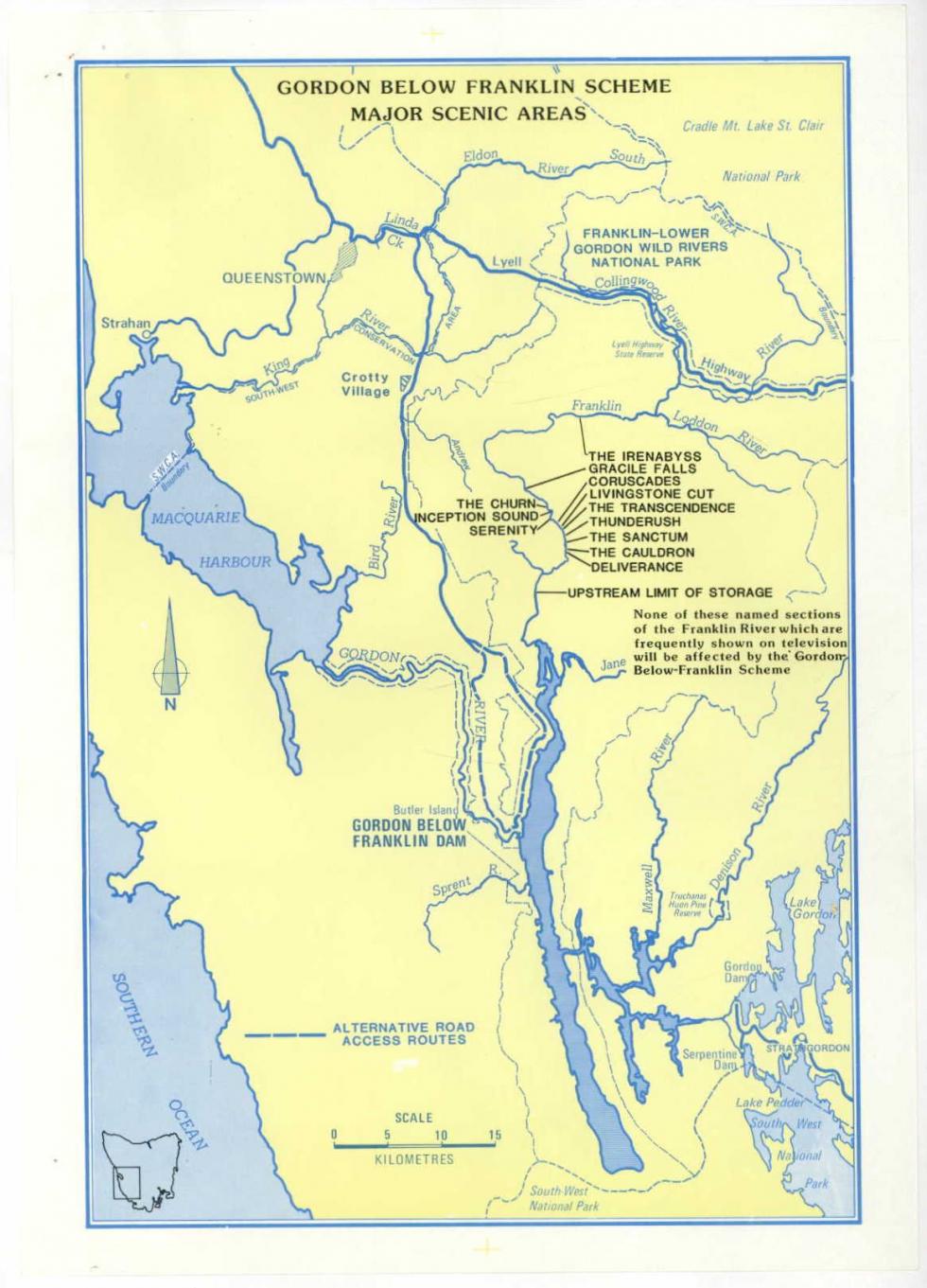
This map was included in the Tasmanian Premier Robin Gray's letter to James Jospeh (J.J.) Carlton, the federal Minister for Health. It accompanied the Letter from Tasmanian Premier Robin Gray about the Franklin Dam, which argued that there was popular support for the dam in Tasmania and claimed that the key features of the river that the conservationists were concerned about would actually be unaffected by the proposed dam.
The map shows that areas described as threatened on many protest materials such as Irenabyss Glacial Falls are clearly upstream from the Gordon-below-Franklin dam site. These areas were used on protest material because of their aesthetic (beautiful or picturesque) quality. Premier Gray consistently argued that these areas would not be impacted by the building of the dam and sought to have the conservationists' campaign discredited on this basis.
However, there are other key areas in the region that were threatened by the dam and are not marked on this map. These key areas include archaeological sites providing evidence of Ice Age habitation. The dam threatened limestone caves which had been undisturbed by European settlers and demonstrated over 20,000 years of continual human occupation of the area by First Nations peoples.
Academics from the Australian National University who studied Australian pre-history worked alongside the conservationists to protest against the dam. The presence of these sites along the river, particularly Kutikina Cave and Deena Reena Cave, were one of the main justifications for granting the area World Heritage status. It was this World Heritage status, granted by the United Nations, that enabled the Australian Government to intervene to stop the dam.
The location's unique flora and fauna are also not represented on this map. This was the other criterion that was used to grant the area World Heritage status. The endemic species (meaning specific to this area) formed a key part of the conservationists' argument about the importance of the region in their campaign.
Food for thought
Why might a map be a persuasive piece of evidence for building the Gordon-below-Franklin dam?
What does this map tell us about the importance of considering the origin and context of a source when we assess its reliability?
On the map, we can see that only some areas of interest have been labelled. Develop an alternative map from the perspective of the conservationists.
Related records
Related themes
Need help with your research?
Learn how to interpret primary sources, use our collection and more.


